GLOBAL
TOP 50
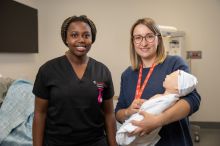
For Nursing
La Trobe confirmed as global leader in nursing education through latest QS World University Rankings by Subject
GLOBAL
TOP 50
For Sport
La Trobe hits it out of the park in the latest QS World University Rankings by Subject
A new wave of
innovation
Cementing our impact in science, health and technology with the opening of our Digital Innovation Hub
Pathway and entry program finder
At La Trobe, you’re more than a number. Use our pathway and entry program finder to plan your way into your dream course.
By choosing La Trobe your impact is real


Top 100 worldwide
We’re ranked in the top 100 universities in the world for our work to advance the UN's Sustainable Development Goals.
Times Higher Education (THE), 2023, Impact Rankings 2023

Ranked #1 in Victoria by employers
Our graduates were ranked 1st in Victoria and 3rd across all Australian universities for overall employer satisfaction

World standard
We’re rated at, above or well above world standard in all our broad research areas
Start your studies at La Trobe
Events
-
Graduate Diploma of Midwifery webinar
Monday 13 May 06:00pm
-

Master of Nursing webinar
Monday 13 May 06:00pm
-
Master of Art Therapy webinar
Monday 13 May 06:00pm
-
Master of Teaching (Primary & Secondary)
Tuesday 14 May 06:00pm
News and stories
-
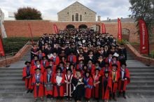
Student achievements shine in Bendigo graduations
La Trobe Bendigo's graduation ceremonies celebrate students
-

La Trobe Business School shines in global rankings
La Trobe Business School shines in global MBA rankings
-
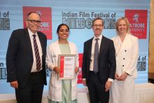
New Delhi student awarded SRK PhD Scholarship
Second Shah Rukh Khan La Trobe University PhD Scholarship awarded
-

Milestone for Albury-Wodonga's newest graduates
Momentous occasion for Albury-Wodonga's newest graduates
Contact La Trobe
Current students
1300 528 762
Future International students
(+61 3) 6145 0033
Future students
1300 135 045
Indigenous Acknowledgement
La Trobe University proudly acknowledges the traditional custodians of the lands where its campuses are located in Victoria. We recognise that Indigenous Australians have an ongoing connection to the land and the University values their unique contribution to both the University and the wider Australian society. Find out more
Things you should know
*QILT, 2023, National Graduate Outcomes Survey – Longitudinal